Ecological research infrastructures in the Netherlands

From experimental mini-ponds to research vessels, and from living labs to collections: in The Netherlands we have many ecological research facilities. This website provides a national overview of the large-scale ecological research infrastructures.
For ecological researchers in the Netherlands this overview offers opportunities to team up with other researchers and to link to existing ecological research facilities and initiatives. Currently, the inventory of large-scale ecological research facilities focuses on ecotrons, scientific (data) collections, long-term field studies and research infrastructures for fieldwork.
Map
List
Filter by
Infrastructure type
Landscape type
Institute
Active filters
Filter by
Infrastructure type
Landscape type
Institute
Active filters
-
Bird Radar
The BirdScan radar is a radar to track aerial movement of animals. This information can be used to gain more insight in migration patterns and the influence of changes in the environment.
-
CLUE field Veluwe + database
Since 1995, we run a series of biodiversity experiments on a former agricultural field in the nature area Planken-Wambuis near Ede. In some plots, secondary succession has followed its natural course, In other plots, a low or high diversity of plants was sown, or the soil has been inoculated with soil from nature areas.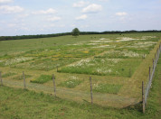
-
Eurasian oystercatcher research population Schiermonnikoog
The long-term study population of Eurasian oystercatchers on Schiermonnikoog is used to study (1) the causes of population change in this indicator species of the Wadden Sea ecosystem, (2) to understand how individuals and populations respond to rapid environmental change.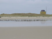
-
Hackfort
Hackfort is an oak coppice grove in the East-Southeast of the city of Zutphen in the province of Gelderland, the Netherlands. The forest is situated at the transition from western riverine deposits and eastern periglacial cover sands.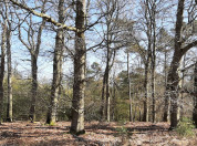
-
Hole-breeding passerines monitoring: Hoge Veluwe
Hoge Veluwe is one of four areas in NIOO-AnE's long-term monitoring research on great tits and other bird species that started in 1955. It consists of a large forest area of more than 350 ha of mainly conifers and oak on poor sandy soil. This area is part of the largest forest complex in the Netherlands, De Veluwe. Every breeding season, many students and researchers are involved in doing field work at Hoge Veluwe.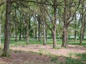
-
Hole-breeding passerines monitoring: Liesbos
Liesbos is one of four areas in NIOO-AnE's long-term monitoring research on great tits and other bird species that started in 1955. It consists of a large forest area of about 100 ha of deciduous trees, mainly oak, on rich sandy-loam soil.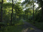
-
Hole-breeding passerines monitoring: Oosterhout
Oosterhout is the last of four areas in NIOO-AnE's long-term monitoring research on great tits and other bird species. Research there started in 1956, one year after the other three areas. It consists of deciduous forest of mainly oak trees on a country estate of about 8 ha, and has a rich clay-sandy-loam soil. Oosterhout has around 150 nestboxes.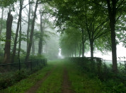
-
Hole-breeding passerines monitoring: Vlieland
Vlieland is one of four areas in NIOO-AnE's long-term monitoring research on great tits and other bird species that started in 1955. It consists of several smaller forest areas, which together cover about 250 ha of mainly conifers and oak on poor sandy soil. As Vlieland is an island in the Wadden Sea, the area stands completely on its own. Important population questions in NIOO's long term research are/were studied here.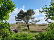
-
Land van Ons - Warmond
The foundation 'Land van Ons' has obtained a peat meadow area near Leiden to increase biodiversity in this intensively used agricultural area. The goal is not to recreate nature, but to develop sustainable agricultural use of this land with the goal of increasing biodiversity in the area and developing management strategies that optimise its ecological, economic and recreational value.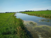
-
LTSER-platform Dutch Wadden Sea
The Long-Term Socio-Ecological research platform Dutch Wadden Sea area is a large coastal area bordering the north of the Netherlands.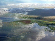
-
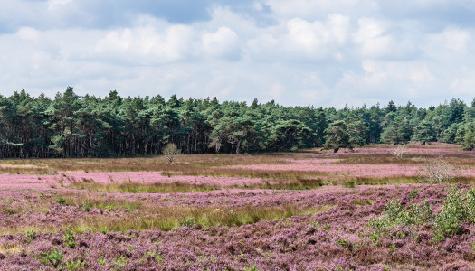
LTSER-platform Veluwe
The area defined as ‘the Veluwe’ lies in the province of Gelderland, the Netherlands, West of the river IJssel and North of the river Rhine. The region hosts the largest connected nature area of the country. The natural landscape consists of a mix of forests, heathlands, sand drifts, lakes, and moorlands and is surrounded by agriculture, settlements, or infrastructure. This means there is a lot of interaction between humans and nature.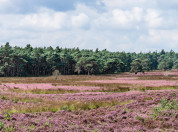
-
Marker Wadden
The Marker Wadden is a newly constructed archipelago in lake Markermeer, which aims to improve the lake’s degrading food web by stimulating primary productivity. The archipelago consists of five islands that add a currently missing habitat type to the lake: shallow, sheltered waters with high nutrient availability and gradual land-water transitions.
www.eco-ri.nl is initiated and maintained by the Netherlands Institute of Ecology (NIOO-KNAW), and supported by the Dutch universities and research institutes connected to NERN (Netherlands Ecological Research Network) and/or BiodiversityXL (Centre of Excellence for Netherlands Biodiversity Research).
The inventory of ecological research infrastructures is ongoing.
Highlighted ecological research infrastructures
-
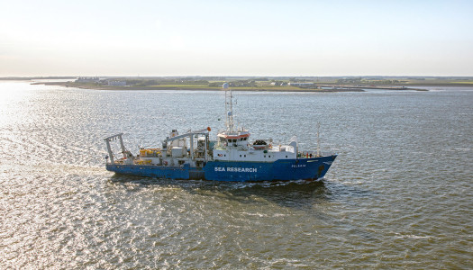
National Research Fleet
The National Research Fleet consists of three research vessels: RV Pelagia, RV Navicula and RV Adriaen Coenen.
-
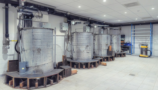
Limnotrons
The limnotrons are nine stainless steel indoor mesocosms with a high level of control.
-
LTSER-platform Veluwe
The Veluwe is the largest connected nature area of the Netherlands, with a great array of ecological and socio-economic research.
Institutes
-
NIOO-KNAW
-
Leiden University
-
NIOZ
-
Radboud University
-
Rijkswaterstaat
-
Utrecht University

-
UVA
-
Wageningen University & Research

-
Westerdijk Institute
Contact
If you have any additions to the inventory, please contact the NIOO Research Support Office via rso@nioo.knaw.nl.