Hackfort
Details
- Infrastructure type
- Field sites / Long-term monitoring
- Landscape type
- Research partner
Study site
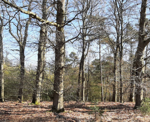
Hackfort is an oak coppice grove in the East-Southeast of the city of Zutphen in the province of Gelderland, the Netherlands. The forest is situated at the transition from western riverine deposits and eastern periglacial cover sands. In 1959, a small forest lot (1.5 ha) has been investigated thoroughly by the former Dutch Institute of Applied Biological Research in Nature (ITBON). The site was selected because of the steep gradients found in soil pH and moisture content. The soil is a riverine deposit with a few elevation differences, making a number of gradients in clay and loam content, which results in many short-distance gradients in soil types.
Research topics
Soil microarthropods, decomposition of organic matter, acid deposition studies, soil science and genesis
References
- Arnold, C. Invloed van Bodemverzuring op Mosmijten (Acari, Sarcoptiformes) in een Eikenhakhoutbosje te Hackfort. Internal Report Research Institute for Nature Management, Arnhem; Rijksinstituut voor Natuurbeheer: Arnhem, The Netherlands, 1989.
- De Vries, W.; Leeters, E.; Hendriks, C.; Van Dobben, H.; Burg, J.V.D.; Boumans, L. Large scale impacts of acid deposition on forests and forest soils in the Netherlands. Stud. Environ. Sci. 1995, 64, 261–277.
- Guo, Y., Siepel, H. (2020). Monitoring Microarthropods Assemblages along a pH Gradient in A Forest Soil over a 60 Years’ Time Period. Applied Sciences 10. 8202. doi: 10.3390/app10228202
- Minderman, G. Mull and mor (Müller-Hesselman) in relation to the soil water regime of a forest. Plant Soil 1960, 13, 1–27.
- Minderman, G. Addition, Decomposition and Accumulation of Organic Matter in Forests. J. Ecol. 1968, 355–362.
- Mulder, J.; Stein, A. The solubility of aluminum in acidic forest soils: Long-term changes due to acid deposition. Geochim. Cosmochim. Acta 1994, 58, 85–94.
- Stams, A.J.M.; Marinka Flameling, E.; Marnette, E.C.L. The importance of autotrophic versus heterotrophic oxidation of atmospheric ammonium in forest ecosystems with acid soil. FEMS Microbiol. Lett. 1990, 74, 337–344.
- Van Grinsven, J.J.M.; Kros, J.; van Breemen, N.; van Riemsdijk, W.H.; van Eek, E. Simulated response of an acid forest soil to acid deposition and mitigation measures. NJAS Wagening. J. Life Sci. 1989, 37, 279–299.
- Weng, L.; Temminghoff, E.J.; Van, W.H.; Van Riemsdijk, W.H. Interpretation of humic acid coagulation and soluble soil organic matter using a calculated electrostatic potential. Eur. J. Soil Sci. 2002, 53, 575–588.
- Went, J.C. Cellophane as a Medium to study the Cellulose Decomposition in Forest Soils. Acta Bot Neerl. 1959, 8, 490–491.
- Went, J.C.; de Jong, F. Decomposition of Cellulose in Soils. Antonie Leeuwenhoek 1966, 32, 39–56.
- Wesselink, L.; Breemen, N.; Mulder, J.; Janssen, P. A simple model of soil organic matter complexation to predict the solubility of aluminium in acid forest soils. Eur. J. Soil Sci. 1996, 47, 373–384.
Running period
1959 – present
Equipment/facilities
The experimental area is about 1.5 ha and is divided in a 10 m x 10 m grid. The grid system is visible in the field with pickets placed in 1956, bearing the coordinates of that point.
Data management
Please contact Prof. Henk Siepel
Available datasets
Microarthropods abundance and taxa 1959, 1987, 2019 (Guo & Siepel, 2020)
Conditions for access
Access to the area for research purposes should be requested from Natuurmonumenten.
When interested in accessing a specific dataset, please contact Prof. Henk Siepel who can further inform you about the instructions and conditions for access to specific datasets.
Details
- Infrastructure type
- Field sites / Long-term monitoring
- Landscape type
- Research partner


